

Carbon Medusa
Notre mission est de démocratiser l'accès aux données marines en réduisant drastiquement le coût et la complexité de l’observation de l’océan.
We are a marine technology startup offering high-resolution, low-cost bathymetric mapping using autonomous surface drones.
We help ports, municipalities, and coastal stakeholders access critical underwater data without the high costs of crewed vessels.
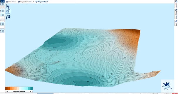
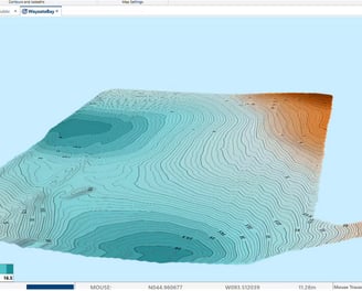
Levée Bathymétrique
What you get :
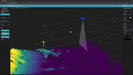
🌍 High-resolution bottom maps up to 50m depth
📡 RTK-corrected, geo-referenced data
🧾 Deliverables compatible with QGIS, Hydromagic, and other GIS tools
📋 Meets IHO Order 2 (non-certified) survey standards
How It Works:
1️⃣ Tell us your mapping needs.
2️⃣ We deploy & operate the USV. No need to train your team or manage logistics.
3️⃣ You get the data. We collect the data and deliver maps within days.
⚡ Much cheaper than traditional vessels
🕒 Rapid deployment and fast turnaround
🚚 Mobile team ready to operate anywhere in France
👷♂️ Inflatable support boat to ensure safe operations
💡 Why it's better :


Nous proposons désormais des levés bathymétriques rapides à l’aide d’un sonar multifaisceaux Cerulean Surveyor 240-16 monté sur notre drone marin (USV) personnalisé.
Parfaits pour :
Autorités portuaires et de navigation
Gestionnaires de marinas et de zones côtières
Bureaux d’études environnementales
Collectivités locales avec des besoins en dragage ou en aménagement côtier
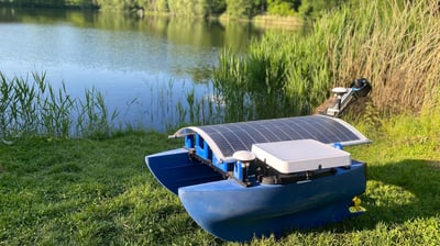
Our Platform — BlueBoat USV, Enhanced by Carbon Medusa
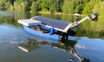
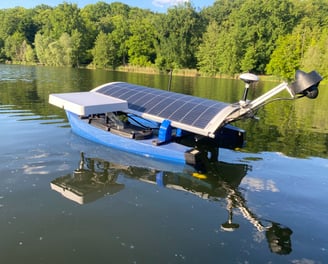
Upgrades include :
✅ RTK GNSS – Unlock precise positioning (3cm).
✅ Multibeam Sonar – Enables high-end bathymetric data.
✅ CTD Profiler – Allows for sound velocity profile corrections for enhanced sonar data.
✅ Radio and Starlink Satellite Connectivity – Real-time data transmission and remote supervision.
✅ Solar Panels – Increased endurance for long duration missions.
✅ Self-Righting Motor –Anti-capsize motor mount and robust ocean-ready design.
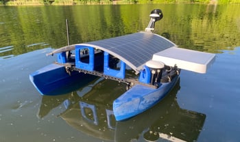
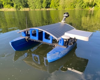
Can be deployed by one operator from shore or dock, enabling quick response anywhere in France.
We’ve taken the affordable Blue Boat Uncrewed Surface Vessel (USV) and supercharged it for real-world conditions
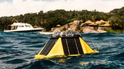
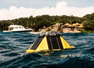
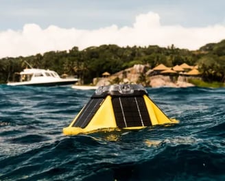
Déploiement de Bouée Metocean
Simple rental pricing :
One time deployment fee then Weekly/Monthly rate
We also offer Sofar Spotter buoy rentals for real-time wave, wind, and ocean condition monitoring.
How it works :
1️⃣ Rent the buoy from us
2️⃣ We handle everything : deployment, mooring, maintenance and retrieval. No need to train your team or manage logistics.
3️⃣ Access live data through an online dashboard
🔭 Coming Soon : Environmental Monitoring
We’re expanding into marine environmental monitoring with future capabilities including :
🎣 CTD profiling (conductivity, temperature, depth)
📈 Turbidity, oxygen, chlorophyll tracking
🔬 Water sample collection